


Six Mile Road is also called McNichols Road. Two Mile Road is Joy Road [[I think). Can someone give me a list of the names for the others?
Is one road chosen/designated [[and renamed) as a 'Mile Road' roughly every mile as you head [[north?) out of Downtown?
Results 1 to 25 of 53
Thread: Mile Roads' other names?
-
September-22-18, 10:54 PM #1
 DetroitYES Member
- Join Date
- Aug 2010
- Posts
- 551
 Mile Roads' other names?
Last edited by night-timer; September-22-18 at 11:10 PM.
-
September-23-18, 06:03 AM #2
DetroitYES Member
- Join Date
- Jul 2009
- Posts
- 4,859
I've never heard of anything other than Joy Rd. The only ones I know of are:
Five Mile Rd outside the city and Fenkell inside.
Six Mile Rd outside and McNichols/E. McNichols inside.
Seven Mile Rd until it changes to Moross on the eastside.
Eight Mile has a few names including Baseline Rd., but I can't recall the others.
I seem to recall that Nine and Ten Mile have other names, but only for short distances.
And no, there is no relation to downtown that I know of.
-
September-23-18, 06:46 AM #3
DetroitYES Member
- Join Date
- Jun 2010
- Posts
- 168
Main article: Roads and freeways in metropolitan Detroit
- Ford Road [[equivalent of 0 Mile Road, western city, suburbs)
- Warren Ave [[equivalent of 1 Mile Road, western city, suburbs)
- Joy Road [[equivalent of 2 Mile Road, western city, suburbs)
- Plymouth Road [[equivalent of 3 Mile Road, western city, suburbs)
- Schoolcraft Road [[equivalent of 4 Mile Road, western city, suburbs)
https://en.wikipedia.org/wiki/Mile_R...tem_[[Michigan)
-
September-23-18, 07:16 AM #4
DetroitYES Member
- Join Date
- Jun 2009
- Posts
- 11,862
Maple is 15 mile right? Big Beaver is.........?
-
September-23-18, 07:37 AM #5
DetroitYES Member
- Join Date
- Apr 2009
- Posts
- 171
Big Beaver AND Metro Parkway is 16 mile.
Is Long Lake 17 mile rd?
-
September-23-18, 08:18 AM #6
DetroitYES Member
- Join Date
- Sep 2016
- Posts
- 179
I've noticed over the past 10 years with speaking in person to people under 30 and from various YouTube videos from Detroit, most Detroiters under 30 are calling McNichols 6 mile rd and Fenkell 5 mile rd. Not sure why young Detroiters are switching over....
-
September-23-18, 08:51 AM #7
DetroitYES Member
- Join Date
- Mar 2009
- Posts
- 5,839
8 Mile is also Vernier going east
6 Mile is also Seymour
And:
"When Detroit was settled, Campus Martius was deemed the center of town because it was where all of these main roads came together. It was the location of the first train station, city hall, and was deemed the starting point for the state's mile road system. The distance between the north end of Campus Martius Park.
CREDIT GOOGLE
Because Campus Martius is on an angle, and Woodward Avenue is too, the mile roads are counted directly north from the park, and the roads run east and west. That makes Michigan Avenue "zero mile," and of course 8 Mile Road is eight miles away."
http://www.michiganradio.org/post/8-...ht-miles-where
Last edited by jcole; September-23-18 at 08:54 AM.
-
September-23-18, 09:45 AM #8
DetroitYES Member
- Join Date
- Mar 2009
- Posts
- 140
I've never known there to be an actual 16 Mile Road. In Macomb County it's known as Metro Parkway and in Oakland County it's called Big Beaver until it's west of Telegraph its name is changed to Quarton Road! Similarly, 18 Mile Road changes to Long Lake Road when entering Oakland County, 17 Mile is called Wattles Road, and 19 Mile Road is renamed Square Lake Road. Further north, 24 Mile, 25 Mile, 31-34 Mile Roads all change onece into Oakland County. Originally Posted by Malcove Magnesia

-
September-23-18, 09:51 AM #9
DetroitYES
- Join Date
- Feb 2009
- Posts
- 6,776
There is a feeble argument for Cherry Hill Rd. to be Zero Mile because that forms the line where the addresses count up or down even though, if one on counts down from 8 Mile, its Minus One Mile Rd. Originally Posted by clubboss
-
September-23-18, 10:04 AM #10
DetroitYES Member
- Join Date
- Aug 2012
- Posts
- 8,853
Originally Posted by Zacha341
Big Beaver and Metro Parkway are both 16 Mile Roads. Their names change in different 'burbs.
-
September-23-18, 10:36 AM #11
DetroitYES Member
- Join Date
- Aug 2009
- Posts
- 1,689
I live near Big Beaver, and everyone around here just calls it 16 mile 'cause it's easier than saying Metro Parkway or Big Beaver or Quarton. Heck, technically Walnut Lake Road becomes 16 mile for a bit. Originally Posted by Honky Tonk
Fun fact - 15 mile has the longest uninterrupted run out west [[next to 8 mile) - all the way to Milford road. This was handy to know when I was trying to get to Brighton one morning and I-96 was closed due to a jackknifed semi.
-
September-23-18, 11:25 AM #12
DetroitYES Member
- Join Date
- Mar 2011
- Posts
- 5,067
In the Bloomfield area, all the mile roads from 15 to 20 are renamed.
Maple, Quarton, Lone Pine, Long Lake, Square Lake, and South Blvd., in order.
Also, 14 is a dirt road in parts and barely exists.
-
September-23-18, 12:37 PM #13
DetroitYES Member
- Join Date
- Mar 2009
- Posts
- 3,184
12 Mile through Royal Oak used to be called Oakwood Avenue.
I'm a millennial, Oakland County native. It's usually 15 Mile and not Maple but Big Beaver, Wattles, Long Lake, Square Lake, Auburn, South, and Tienken beyond that. But when speaking for Macomb County it's the mile name.
-
September-23-18, 01:21 PM #14
DetroitYES Member
- Join Date
- May 2016
- Posts
- 379
Easier for them to spell/text.
-
September-23-18, 01:59 PM #15
DetroitYES Member
- Join Date
- Apr 2009
- Posts
- 7,049
Technically, 7 Mile splits of from Moross and terminates at Kelly. Originally Posted by Meddle
Also, McNichiols become Seymour east of Gratiot.
-
September-23-18, 02:00 PM #16
DetroitYES Member
- Join Date
- Apr 2009
- Posts
- 7,049
8 mile is similar to 7 Mile, in that it splits off and terminates just east of Harper. Originally Posted by jcole
-
September-23-18, 03:16 PM #17
DetroitYES Member
- Join Date
- Aug 2012
- Posts
- 8,853
Originally Posted by Former_Detroiter
The first settlers were really forward thinkers.
-
September-23-18, 04:42 PM #18
DetroitYES Member
- Join Date
- Jun 2015
- Posts
- 1,416
Like others, I agree this is debatable. Some consider Vernier another name for 8 Mile, some say it's a different road, on a different angle, and that 8 Mile has been eliminated in places but still exists in vestiges East of Vernier along its due East-West route. I fall into the latter category, but we can both be right. Originally Posted by jcole

Last edited by bust; September-23-18 at 04:45 PM.
-
September-23-18, 04:45 PM #19
DetroitYES Member
- Join Date
- Apr 2009
- Posts
- 170
Growing up the the 80s I'd heard Davison through Highland Park referred to as 4 Mile.
The way McNichols turns NE at Gunston, I'd say it's no longer 6 Mile, and Seymour is closer to being 6 1/2 Mile, but Spring Garden is closer to the true 6 1/2 Mile.
Houston Whittier is the true 6 Mile on the east side, and it even continues the same directional pattern as Moross and Vernier, although its name changes to Whittier.
But even though they are each a mile apart, Whittier, Moross and Vernier, while extensions of Mile Roads, really are not. As has been pointed out, 7 Mile and 8 Mile both continue on east past where Moross and Vernier start.
And I have no idea how 3 Mile Drive got its name.
-
September-23-18, 05:19 PM #20
DetroitYES Member
- Join Date
- Apr 2009
- Posts
- 4,513
A lot of the mile roads had local names in the past. 11 Mile was First St. in Royal Oak. Nine Mile was Sycamore Ave. in Ferndale [[and Urban Rest, the old resort town at Hilton north of 9 Mile). 11 Mile was Town Hall Rd. in Roseville [[the Erin Twp. Town Hall was at the corner of Gratiot). Many other such local namings can be found on old maps. Originally Posted by dtowncitylover
But eventually it seems to have been generally agreed upon that mile roads from 7 to 14 would be known as "X Mile Rd." From there north though, there remains a plethora of local namings, although mostly in Oakland County. In Macomb the numbers seem to be mostly used, out to, what, 37 Mile?
Here can be found a somewhat erroneous and incomplete list of alternate names for the mile roads, old and current:
https://en.wikipedia.org/wiki/Mile_R...tem_[[Michigan)Last edited by EastsideAl; September-23-18 at 05:31 PM.
-
September-23-18, 05:21 PM #21
DetroitYES Member
- Join Date
- Apr 2009
- Posts
- 4,513
That road, east of where most Eight Mile traffic swings onto Vernier, is locally called "Old Eight Mile". Originally Posted by bust
Last edited by EastsideAl; September-23-18 at 05:47 PM.
-
September-23-18, 05:30 PM #22
DetroitYES Member
- Join Date
- Apr 2009
- Posts
- 4,513
Ford Rd is basically on the same alignment as Michigan Ave. coming from Campus Martius downtown [[before Michigan swings southwesterly to head off into Dearborn and beyond). Which is why, when driving eastbound on Ford Rd. near Wyoming on a clear day, you can see downtown straight in front of you. Originally Posted by clubboss
-
September-23-18, 10:01 PM #23
DetroitYES Member
- Join Date
- Aug 2009
- Posts
- 1,689
That's funny, when I lived on the East Side half the people I knew interchanged Vernier with 8-Mile, and the other half insisted they were different roads. Originally Posted by bust
I wish planners would keep the name for the same road. Really, when 8-Mile curves into Vernier, you have to get off of 8-Mile/Vernier to get to East/Old 8-Mile. This is just confusing, especially if you aren't from the area. Highways I can see an argument for, but surface roads should have one name wherever possible.
-
September-24-18, 06:22 AM #24
DetroitYES Member
- Join Date
- Mar 2009
- Posts
- 5,839
Growing up at 7 and Kelly and going to high school at 8 and Kelly, we always just called them 7 and 8 Mile respectively all the way to at least Mack. So did the Mack and 7 shopping center. But technically, you are probably correct.
Originally Posted by bust
-
September-24-18, 06:27 AM #25
DetroitYES Member
- Join Date
- Mar 2009
- Posts
- 5,839
Springgarden dead ended behind Assumption Grotto, so taking Seymour from Denby area took you straight through to Gratiot without having to job over and you ended up on McNichols by the Ben Franklin Library; probably why we considered it the same road
Originally Posted by middetres

 Reply With Quote
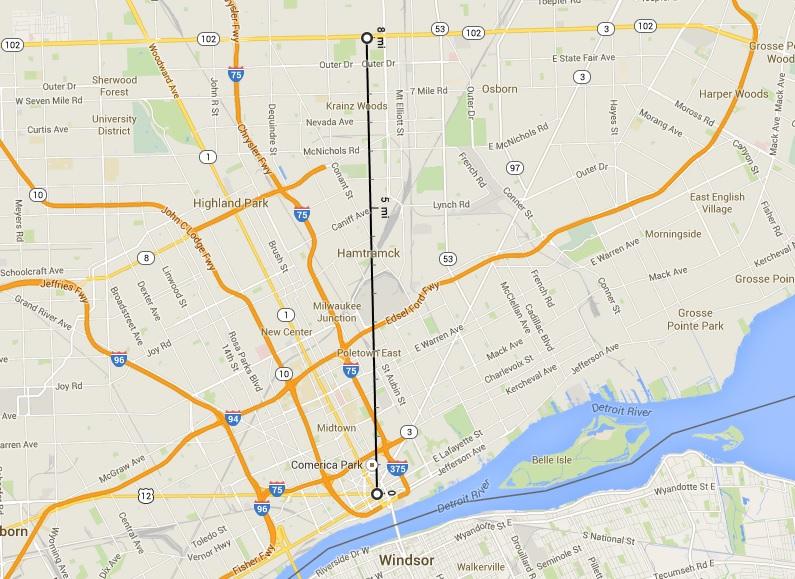
 Posting Permissions
Instagram
DetroitYES navigation
DetroitYES Management
© AtDetroit LLC 2000 - 2024 unless otherwise specified. Please notify us of uncited proprietary content.
Welcome to DetroitYES! Kindly Consider Turning Off Your Ad BlockingX
DetroitYES! is a free service that relies on revenue from ad display [regrettably] and donations. We notice that you are using an ad-blocking program that prevents us from earning revenue during your visit.
Ads are REMOVED for Members who donate to DetroitYES! [You must be logged in for ads to disappear]
Ads are REMOVED for Members who donate to DetroitYES! [You must be logged in for ads to disappear]
DONATE HERE »
And have Ads removed.
And have Ads removed.
Bookmarks