


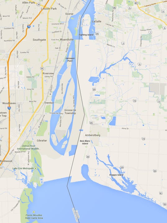
International Metropolis attached.Google Maps accomplished what the earth's shifting tectonic plates, the heavens, and/or a higher being have not.
The well-known digital mapping service showed the Detroit River south of Grosse Ile as land, connecting downriver Wayne County and southwestern Ontario. The error was corrected this evening.
According to Google Maps images that popped up Thursday, there was an entire new land mass that extended from south of the Wayne County city of Gibraltar, across to Canada's Essex County south of Amherstburg, Ontario.
Results 1 to 3 of 3
-
January-30-15, 10:38 PM #1
 DetroitYES Member
- Join Date
- Mar 2009
- Posts
- 8,169
 Google Maps shows land bridge from downriver to Canada
-
January-31-15, 07:37 AM #2
 DetroitYES Member
- Join Date
- Feb 2010
- Posts
- 3,901
Matty Maroun was OUTRAGED! Just OUTRAGED!
-
January-31-15, 08:04 AM #3
DetroitYES Member
- Join Date
- Feb 2010
- Posts
- 1,629
Parts of Grosse Ile were also underwater.


 Reply With Quote
 Posting Permissions
Instagram
DetroitYES navigation
DetroitYES Management
© AtDetroit LLC 2000 - 2024 unless otherwise specified. Please notify us of uncited proprietary content.
Welcome to DetroitYES! Kindly Consider Turning Off Your Ad BlockingX
DetroitYES! is a free service that relies on revenue from ad display [regrettably] and donations. We notice that you are using an ad-blocking program that prevents us from earning revenue during your visit.
Ads are REMOVED for Members who donate to DetroitYES! [You must be logged in for ads to disappear]
Ads are REMOVED for Members who donate to DetroitYES! [You must be logged in for ads to disappear]
DONATE HERE »
And have Ads removed.
And have Ads removed.
Bookmarks