I was reading the Wikipedia entry for Center Line and it claimed the French named it Center Line because it was the middle of three Potowatomi trails from Fort Detroit to northern trading posts. Were roads eventually built over these trails? How far out did these trails extend? Did these trails extend all the way through the lower UP? I know that Moravian was a trail/road that went deep into the wilderness, but I didn't think any other trails went that far out.
Yea, I know it's Wikipedia, but it was taken from a prtty good book written by Walter Romig.
Results 1 to 14 of 14
-
October-24-14, 02:25 PM #1
 DetroitYES Member
- Join Date
- Mar 2009
- Posts
- 1,470
 Potawatomi trails from fort Detroit [[Center Line)
Last edited by Patrick; October-24-14 at 02:27 PM.
-
October-24-14, 02:40 PM #2Willi Guest

Delaware Indians, in the mid 1780’s escaping from marauding
American militia, sought refuge along the
Clinton River on land granted by the Chippewa.
Clarence M. Burton the prominent historian stated
“A band of Moravians went to Gnaden-huetten”
[[a settlement just west of Mt Clemens
on the bank of the Clinton River)
“in the spring of 1782 to collect corn they
had planted the previous fall.”
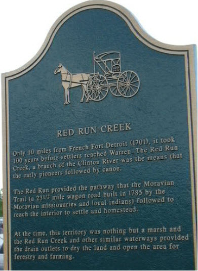
A road was needed because the ground
was often too muddy for wagons filled with
grain to be sent to the mill in Detroit.
By 1786 this group of Moravian Indians
had built the first inland road in Michigan
in order to carry their wheat
to the mill on Tremble Creek.
It ran 23 and one half miles from what is now
Southwest Mt. Clemens along the south branch
of the Clinton River, along Red Run,
then heading south along Bear Creek
down what is now Sherwood,
then Southeast along Connor
which was along Tremble’s Creek
now Connor’s Creek to Tremble’s mill.
At the point where 10 mile road crossed
this old trail road; Kunrod’s Corners was
established which eventually lead to the
creation of Center Line.


Last edited by Willi; October-24-14 at 02:54 PM.
-
October-24-14, 03:18 PM #3
 DetroitYES Member
- Join Date
- Apr 2009
- Posts
- 4,513

According to the city's own website, the road built on the "center" trail was Sherwood. And the original settlement, known as Kunrod's Corners, was at Sherwood and 10 Mile.
I always thought the name Center Line had something to do with the Detroit & Bay City railroad [[later a part of Michigan Central) that was run through there in the 1870s. Particularly since the first "Centre Line" post office originates around that time.
-
October-24-14, 03:20 PM #4
 DetroitYES Member
- Join Date
- Mar 2009
- Posts
- 8,173

Some more info: INDIAN TRAILS
-
October-24-14, 03:57 PM #5
 DetroitYES Member
- Join Date
- Mar 2009
- Posts
- 4,317

Most of our major roads followed trails laid by the original inhabitants, who were pretty good judges of the safest, straightest, most direct routes from point to point. It is pretty hard to get anywhere in Michigan without following a trail mapped out by the displaced ones.
-
October-24-14, 06:21 PM #6Willi Guest

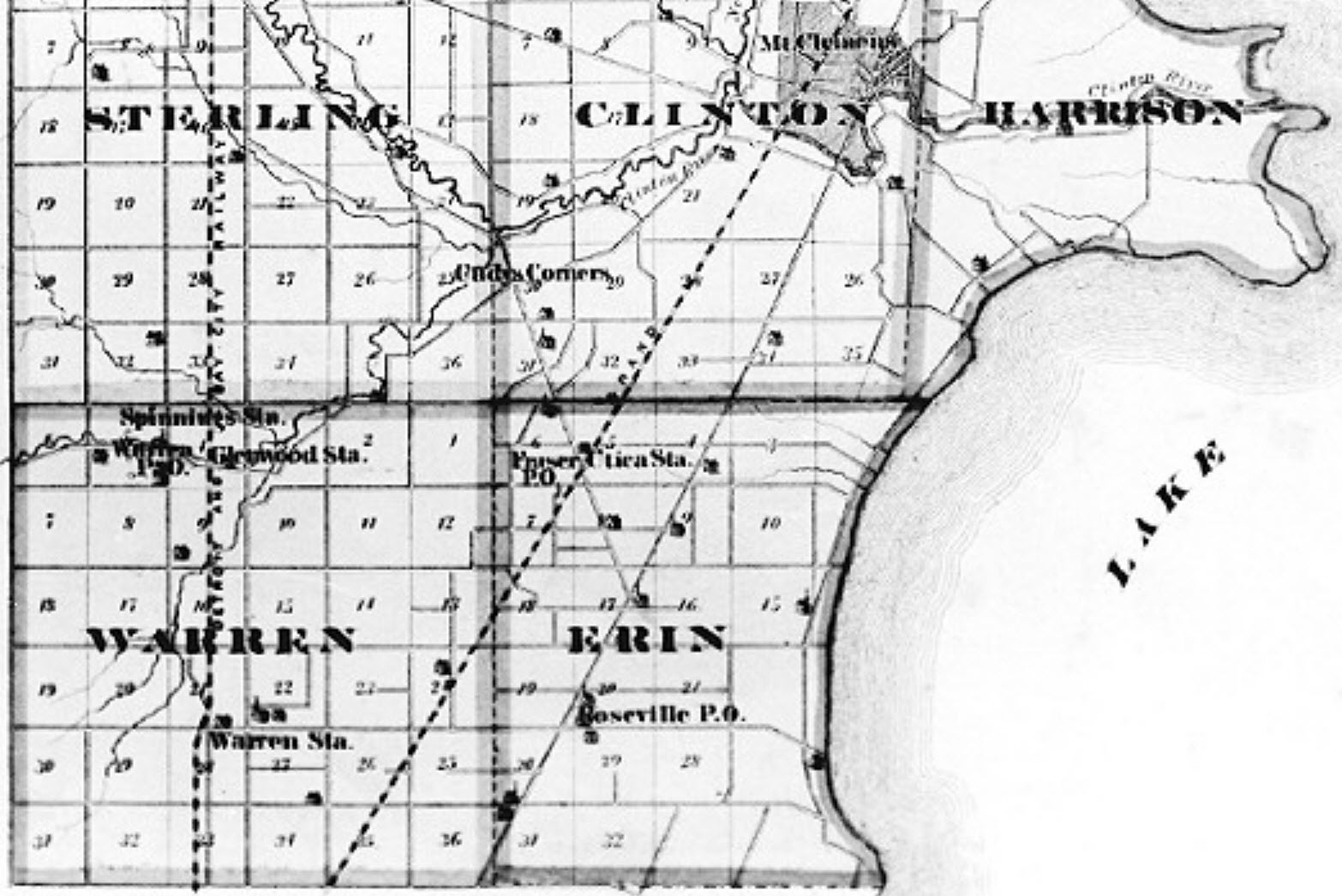
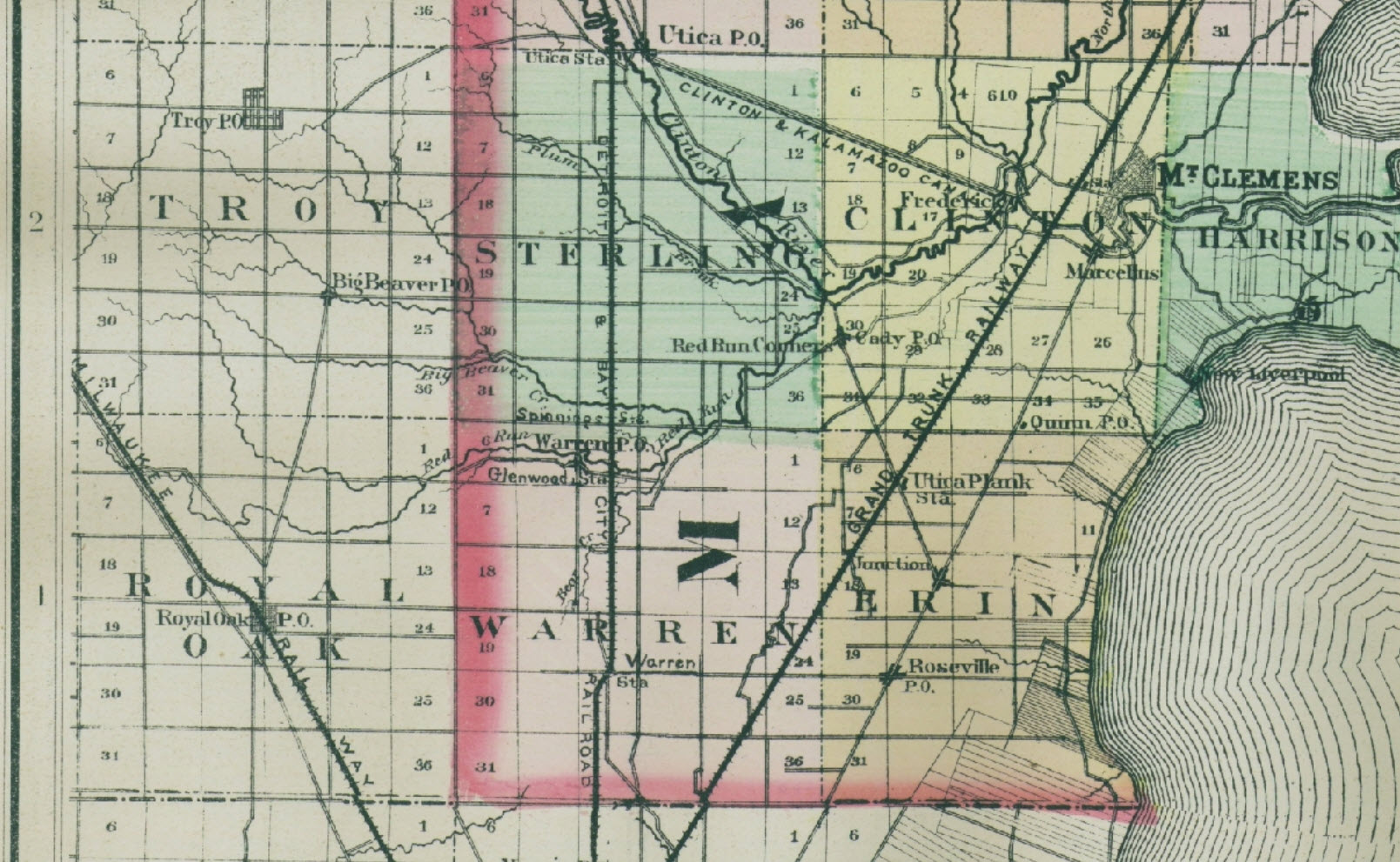
Red Run Corners dates back to mid 1800’s
associated with the Cady Post Office
and GTRW railroad Utica Plank station.
The river was originally named via
Nottawaseppi by
Huron Band of the Potawatomi http://www.nhbpi.com/
The 2 railroads show up nicely in this map.

Last edited by Willi; October-24-14 at 06:26 PM.
-
October-24-14, 06:23 PM #7
 DetroitYES Member
- Join Date
- Mar 2009
- Posts
- 1,370

Here is a portion of Joseph Wampler's 1817 survey map of Township T1 R12 [[which became known as Warren Township), showing the location of an "Indian path". Section 21 is bounded by present-day Mound, Van Dyke, 10 and 11 Mile Roads. The Indian path crosses the southern edge of Section 21 at the approximate location of present-day Sherwood.
-
October-25-14, 12:41 AM #8Willi Guest

A little evolution, progress and time - it's back to a trail

-
October-25-14, 09:09 AM #9
 DetroitYES Member
- Join Date
- Mar 2009
- Posts
- 1,470

Good stuff from MikeG and company...so another question.Mound Road was named after native burial mounds along a trail?
-
October-25-14, 03:52 PM #10
 DetroitYES Member
- Join Date
- Mar 2009
- Posts
- 1,370

According to a book written by Don Binkowski [[a former Warren, MI district judge) about Col. P.W. Norris, Mound Road takes its name from a sandy knoll that Norris christened "Prairie Mound". It was located at what is now Mound Rd. just north of Seven Mile Rd.
Philetus Norris was, among many other things, a land developer who subdivided an area which he named "Prairie Mound" but which later became known as Norris and after that North Detroit and Nortown.
This USGS topographical map shows a rise in elevation that peaks at 630 feet above sea level on Mound Rd. just north of Seven Mile Rd. This knoll was on the northwest outskirts of what would become Col. Norris' Prairie Mound subdivision plat. At the time Norris incorporated his Detroit & Prairie Mound Plank Road Company in 1871, this elevated land feature [[along with the land to the southeast that he intended to subdivide) was located on property owned by Norris.
Col. Norris had spent the previous summer of 1870 exploring the Montana Territory, including portions of what would soon become Yellowstone National Park. From his travels, Norris would have seen numerous naturally-occurring "prairie mounds" [[aka "mima mounds") in the west and thus it would not be surprising for him to call the sandy knoll on his property "Prairie Mound". He then proceeded to use that name for his plank road and for his proposed subdivision plat, except for the last-minute intervention by friend and supporter who changed the name to Norris.
Col. Norris' intent as a land developer and sales agent was to trade on that name and embellish it with the unsubstantiated claim that his "Prairie Mound" was a constructed burial mound. However, according to feedback Judge Binkowski received from experts at Wayne State University and the State of Michigan, there is no physical or historical evidence that it ever contained any constructed burial mound[[s).
Therefore, one has to conclude that Mound Rd. is named after the natural land feature that once existed near its intersection with present-day Seven Mile Rd. and which was named "Prairie Mound" by Col. Norris.Last edited by Mikeg; October-26-14 at 12:24 PM.
-
October-25-14, 04:09 PM #11
 DetroitYES Member
- Join Date
- Mar 2009
- Posts
- 1,370

Here is a drawing titled "Bird's Eye View of Norris, Wayne Co., Mich." that appears on page 21 of Belden's 1876 Wayne Co. Atlas of Townships .
Above is a partial view of that drawing. The view is looking to the north and Mound Ave. [[Mound Road) is shown as ending in a tee intersection with what is current-day Seven Mile Road. That intersection is the general location of the rise in elevation which I mentioned in the earlier post.
Mt. Elliot Ave. is also shown on the full size drawing, which was originally the route of Norris' Detroit & Prairie Mound Plank Road.
-
October-25-14, 04:30 PM #12
 DetroitYES Member
- Join Date
- Mar 2009
- Posts
- 1,370

From the "Michigan Geological and Biological Survey [[1913)":
Ennis was Norris' son-in-law and I would take his claim of finding "bones associated with Indian relics" with a grain of salt. Even if true, it does not indicate that the mound itself was constructed by the Indians.
According to Judge Binkowski's book, Col. Norris was first and foremost a real estate speculator - as well as a promoter extraordinaire. I believe that Norris put the "Mound" in Prairie Mound just like the first elected city fathers put the "Heights" in Sterling Heights.Last edited by Mikeg; October-26-14 at 12:26 PM.
-
October-25-14, 06:04 PM #13Willi Guest

Not so sure the 630 ft elevation had a whole lot to do with it.
Many many areas around Warren and Madison Heights were at around 630 feet.
Perhaps it had more to do with Crescent Shape or some other odd feature.
Maybe it was flood plain deposit material from a local water way ? Hey I'm guessing !
I've been researching elevation, flooding, water tables, etc, for a while now.
The whole area is just pretty darn flat with very little change in elevation, no gradient.
Equipment was not as sophisticated back then, survey techniques evolved, etc.
http://redrundrain.files.wordpress.com/2014/03/warren-south.jpg
http://redrundrain.files.wordpress.com/2014/03/warren-middle.jpg
http://redrundrain.files.wordpress.c...rren-north.jpg
http://redrundrain.files.wordpress.c...rth-warren.jpg
https://picasaweb.google.com/lh/phot...eat=directlinkLast edited by Willi; October-25-14 at 06:09 PM.
-
October-25-14, 08:45 PM #14
 DetroitYES Member
- Join Date
- Mar 2009
- Posts
- 1,370

Click here for a street view of a location 2.5 miles to the southeast of "Prairie Mound" to see what happens to a hill when a road is built through it.
The 630 ft elevation at Mound and 7 Mile Rd. is all that remains of "Prairie Mound" a century later after the construction of subdivisions and roads have leveled it to a barely-detectable rise in elevation as measured by the USGS.
Tags for this Thread
Welcome to DetroitYES! Kindly Consider Turning Off Your Ad BlockingX
DetroitYES! is a free service that relies on revenue from ad display [regrettably] and donations. We notice that you are using an ad-blocking program that prevents us from earning revenue during your visit.
Ads are REMOVED for Members who donate to DetroitYES! [You must be logged in for ads to disappear]
Ads are REMOVED for Members who donate to DetroitYES! [You must be logged in for ads to disappear]
DONATE HERE »
And have Ads removed.
And have Ads removed.


 Reply With Quote


Bookmarks